|
Models - Unisys & Ohio Snow |
|||||||||||||||||||||||||||||||||||||||||||||||||||||||||||||||||||||
Other Models: |
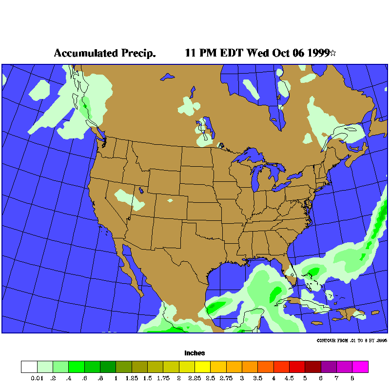
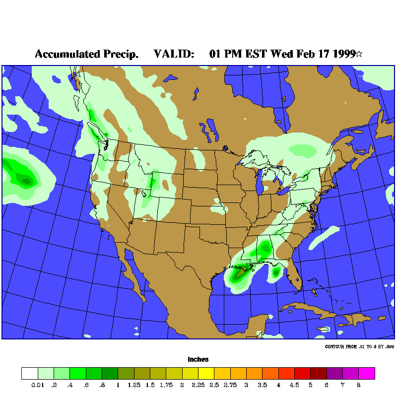
This is the new Unisys Snow Model (which replaces the Purdue
Models) that has just come out. It is very good in model representations and easy to
read. This model is based on ETA model outputs.
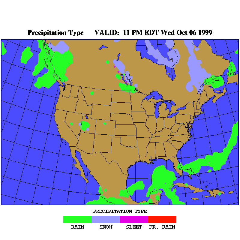
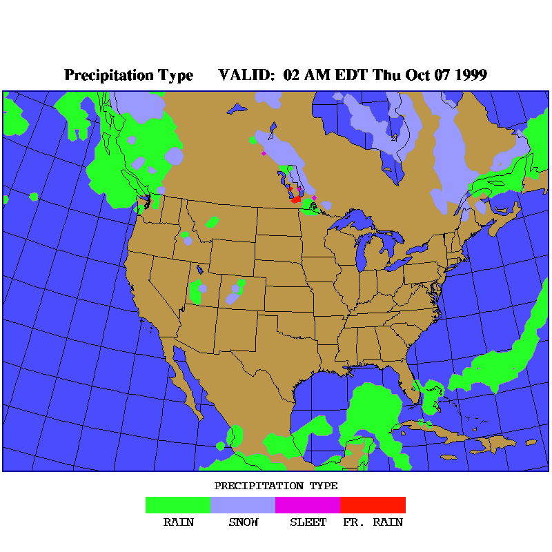
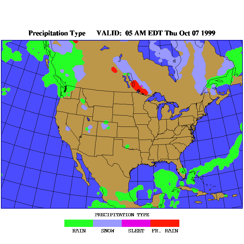
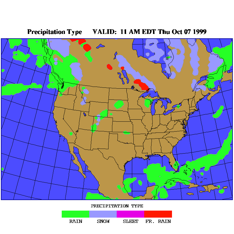
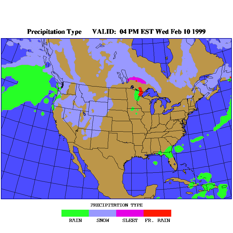
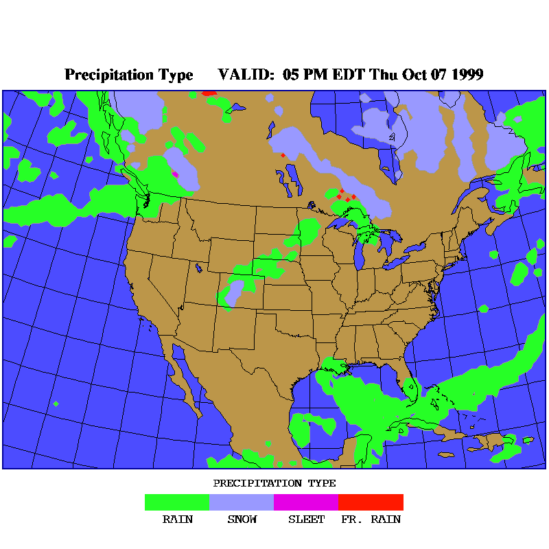
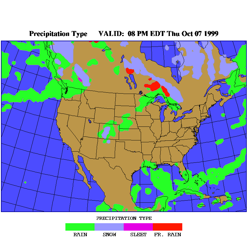
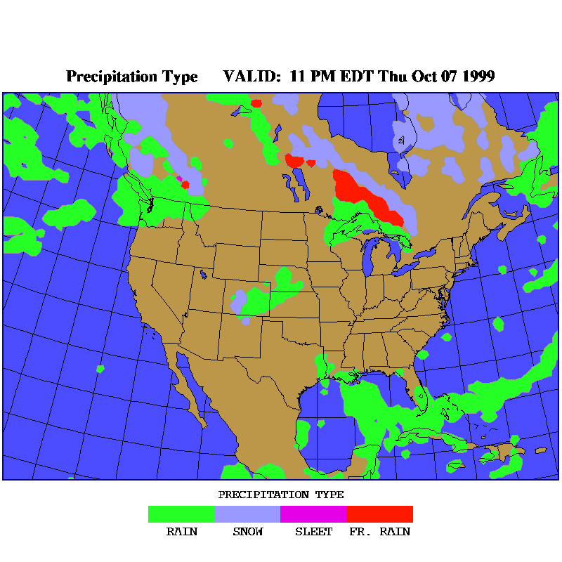
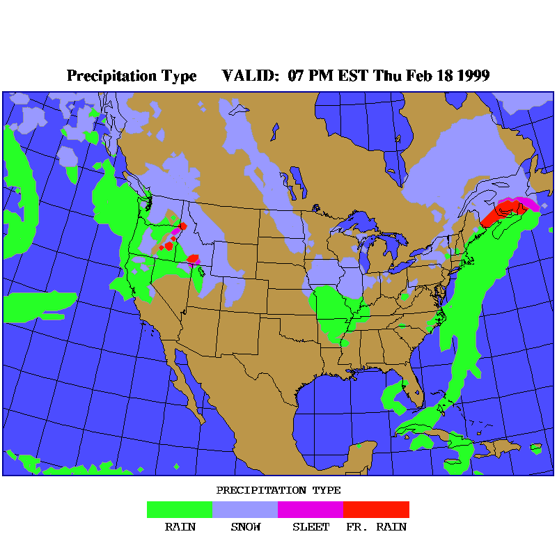
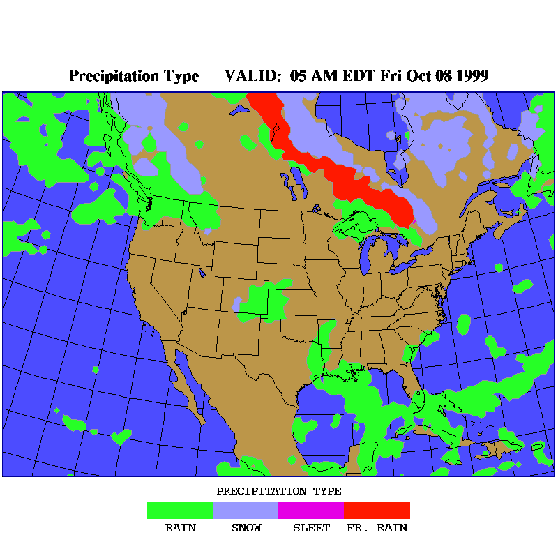
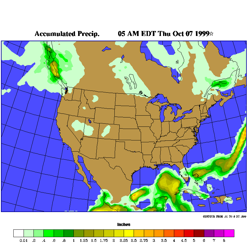
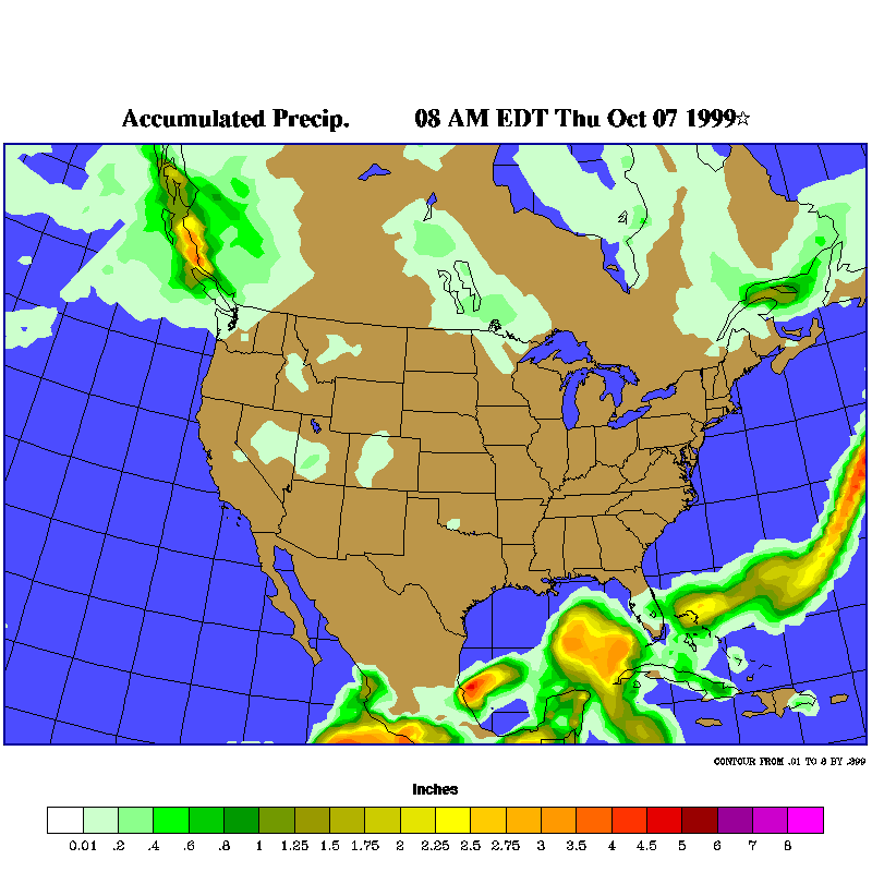
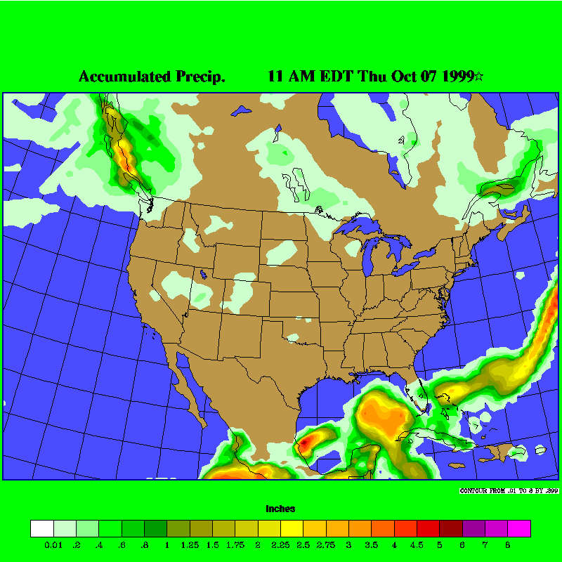
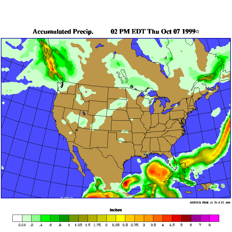
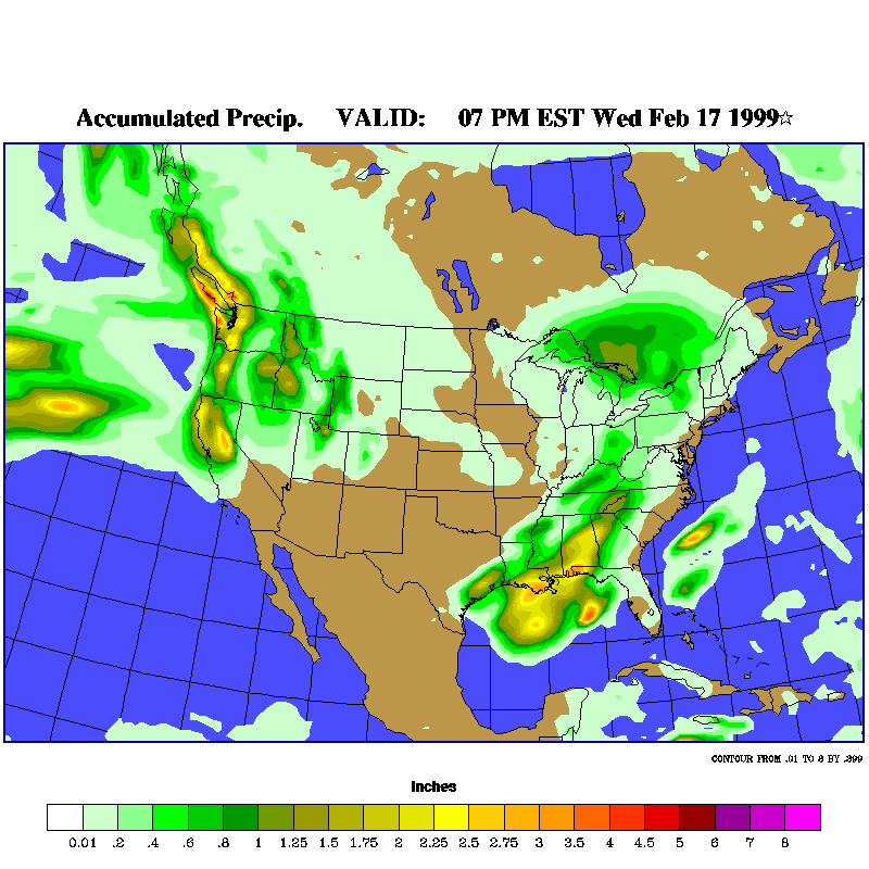
This is the Ohio Precipitation Model. It tells which areas are going to experience rain, snow or freezing rain during a period and then how much accumulation will occur. A good rate of snowfall is 1 inch of water equals 12 inchs of snow.
|
||||||||||||||||||||||||||||||||||||||||||||||||||||||||||||||||||||
Copyright 1997,1998,1999: The Ontario Weather Page |