|
|
|
|
Tuesday, August 02, 2025 |
Over 48,494,314 pages visited! |
| GMT: 09:26 |
PACIFIC: 2:26:06 AM |
MOUNTAIN: 3:26:06 AM |
CENTRAL: |
EASTERN: 5:26:06 AM |
ATLANTIC: 6:26:06 AM |
NEWFOUNDLAND: 6:56:06 AM |
|
|
|
|
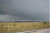
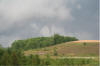
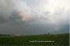
I woke up pretty early on Sunday after looking at the models around 3 am and seeing a really slight chance of tornadic storms in the province. Firing up the computer, I saw a line of storms heading across southern Ontario and drove a short time north for Fergus to find out it was nothing special and drove back home. I checked Ruc models and 12z GFS and WRF and decided that today did hold promise in the afternoon if we got some clearing and heat. So it was load up the truck and wait. At 3 pm edt, I began to notice a boundary from the morning convection to my west trailing northwest into Lake Huron. On the northeastern edge around northern Michigan, a nice strong to severe storms was slowly heading southeastward.
My Chase GPS Chase Log
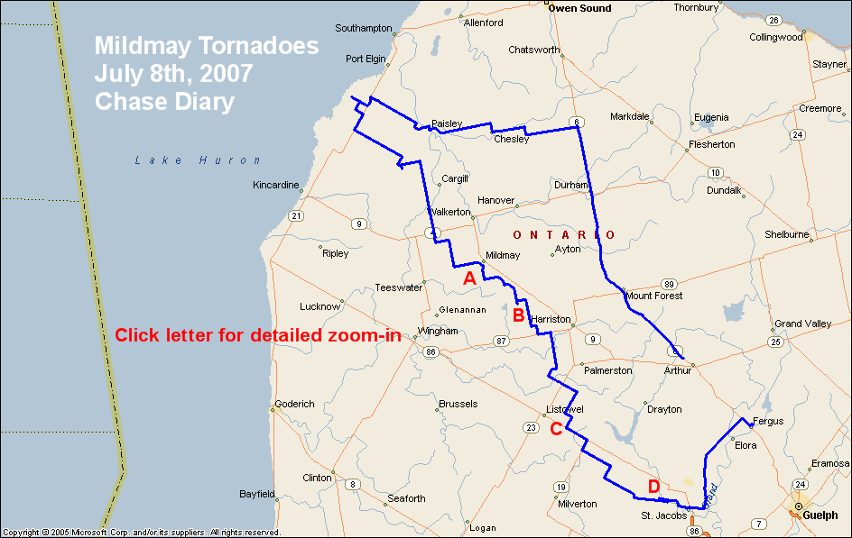
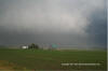
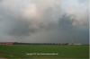
I took off heading north towards Mount Forest as my original target was between Owen Sound and Southhampton. After a phone from my wife Kristy who offered to nowcast, my target area became more westerly as the storm was showing signs of right turning over the lake. I pulled into the region just south of Port Elgin and set up to watch the storm coming in. As it arrived, it really did not look all that great on radar or organized but it was still a nice storm after not chasing for over a month. I snapped a few photos and slowly headed southeast following it.
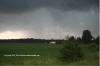
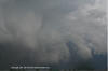
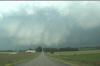
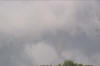
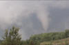
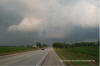
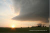
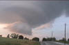
I made a quick phone to Kristy and she had said things really did not look all that great but was still showing signs of rotation. As I was talking to her, I noticed this feature to my northeast. This 1st thing I thought was this reminds me of that feature we could never identify in the 2005 South Plains tornado! So off I took to take a look at it and get out of the little bit of rain I was encountering. This is about the time that the storm seemed to morph. You could just feel the energy as it rapidly strengthen and started to organize. It had hit the boundary from the mornings storms and became the biggest supercell I have seen in Ontario in the last 13 years of chasing here. Right before my eyes a huge wallcloud just developed and rotating like a top around 6:15pm.
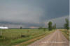
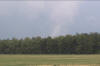
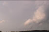
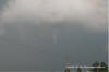
 As I was on the phone with Environment Canada saying this was rapidly rotating and possibly on the ground due to the black dirt it was kicking up, the wall cloud became one the most intense I have seen in North America. At the time of these pictures you can see the dirt and dust being kick up in the wall cloud and hail being wrapped around with the rfd. Not sure if any damage was reported but it was really moving stuff around in there indicating a large ground circulation. At the end of the 1st wall cloud, a small tornado formed for about 20 secs before dissipating.
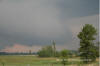
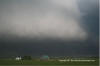
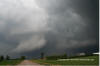
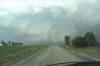
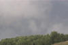
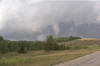
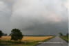
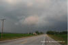
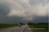
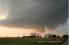
But this storm was not done. Visible areas of rotation were all around me but very disorganized,
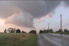
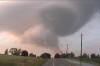
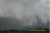 And then it really got organized and produced the biggest wall cloud I have ever seen. Had trouble fitting the size of it in my camera. 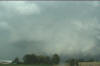
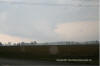
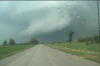
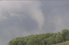
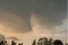
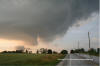
This was heading straight for the town of Mildmay. I got on the phone to E.C. about locations when I saw my 3rd tornado of the day. I have taken a vid cap of it. Although the quality sucked, it was there. 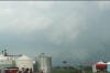 Pulling into the outskirts of Mildmay, I realized it would just miss them and stay in rural areas. I pulled over to the side of the road around 6:53pm to see what I thought was a nice white cone tornado. I am not sure if this was the same one or a new tornado but I headed further south to find a better position to film it. 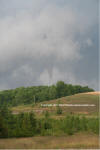
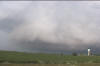
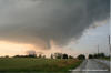
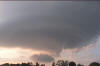
  20 meg low res video After viewing multiple touchdowns and quite possibly there being 2 separate ones, I then spotted a weak one to my east as the wall cloud totally felled apart ( you can just see it to the left of the road). This one last no more than a min. 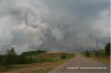
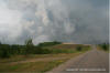 north that last for about 30 seconds before roping out. Just as I figure it is over, another weak tornado becomes visible to my north and then slowly ropes out. 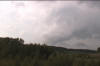
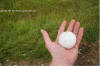
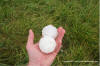
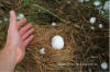
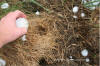
 After that tornado dissipates, I headed southeast to see another funnel at 7:12pm to my east. I never seemed to touch down but last a good min before dying out. 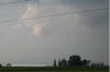 After getting blocked in a road by a few trees that were down, I finally spotted some hail that I could measure. The largest I found at this site was lime sized or 52 mm/2 in. 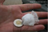 I continued southward and spotted a ton of trees and fields shredded. I hike into them and found a bunch of baseball to tennis ball size hail and a few embedded into the wet ground (72mm or 2.75) This had probably melted for a good 20 mins so it was probably larger. 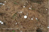
 The storm seemed to cycle again and I had the chance to catch up with it outside of Listowel where a new wall cloud formed and a funnel developed. I quickly took a few pics and continued to head southeast. 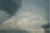
Getting about 8 kms to the southeast of Listowel, I noticed to areas of strong rotation forming. I pulled over to beginning filming and was amazed to see dual wall clouds forming at the same time. Watching this in awe, It turned into a copycat act as both wall cloud produced funnel clouds for about 15-20 secs before then died out. AS they died out, some people pulled over and asked me if I had seen the funnel cloud to the east of Listowel about 8 mins ago. They finished tell me that it did touch down and hit a small shed or something and then only saw the funnel above it with no visible evidence at the surface. 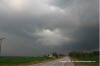
 Just when I figured this storm was all over, it seemed like it turned into an LP supercell during the end. It was awesome to see all the rotation in the upper levels and then the wall cloud formed underneath with what looked like a funnel. It never did touch down but just as the storm died it produced 3 midlevel funnel clouds that snake around for a good 3 mins before the whole thing finally died.
  What a chase day in Ontario. Structure and motion I have only seen in Tornado Alley before now. Need to thank Kristy for doing constant nowcasting for almost 3 hours while I chased this.
All Images, graphics Etc are copyrighted Dave Patrick unless otherwise stated. |
|
� 1997-2016 The Ontario Weather Page |